The Widforss Trail is about 5 miles one way and the elevation at the start is 8,058 feet. The trail is named for artist Gunnar Widforss who lived and painted at the Grand Canyon in the 1930s capturing with watercolor the surrounding environment.
We decided to take the short option (5 miles round trip with an elevation gain of 590 feet) of turning back halfway, but at the halfway point, we thought we were fresh so kept going. As we hiked along I realized that we couldn't make it to the end of the trail and turn back to arrive at our car by nightfall because we were too slow, ate lunch, and we had taken so many photo detour breaks. Not sure how close we got to the end, but someone who had passed us on the way in and then passed us on the way out kindly said the trail's end wasn't as spectacular as the scenery we had already seen along the way.
 |
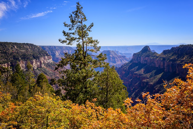
| View to Transept Canyon |
This hike had the best fall color in the scrub oaks and aspens. The trail runs along Transept Canyon with views to Bright Angel Canyon beyond. It travels through meadows, along the rim, and into an old burn scar with aspen/ponderosa regrowth.
It was definitely dusk when we arrived back at my car. It was a great day and a beautiful hike.
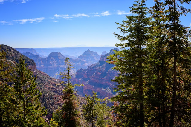
Another day, another hike. We hiked the Cape Final Trail which travels through well thinned Ponderosa forests to the canyon's rim. The trailhead is accessed from the Cape Royal road. This 4-mile round trip hike has an elevation gain of 499 feet. Most of that gain is in the first 3/4 mile. It is a decent hike with dramatic scenery.
Leaving Cape Final we stopped in at Point Imperial. The Point Imperial viewpoint is the highest point in the Grand Canyon at 8,803 feet (2683 meters), and it is the park's northern most boundary. The light wasn't so great so we stopped again the next day as we were leaving the North Rim.
 |
Point Imperial landscape with the Vermillion Cliffs in the distance on the left
|


Comments
Post a Comment