At our friend Sue Durling's suggestion, we took the scenic route from Grand Canyon to Oro Valley stopping at Tonto National Monument to see the cliff dwellings. We walked up to the lower cliff dwellings on a paved, half-mile path that ascends about 350 feet. There is another, farther set of cliff dwellings which require a reservation and a park service guide to get there.
At least 10,000 years ago hunters and gatherers moved through the Tonto Basin area. With the introduction of agriculture, people began building more permanent structures for their homes. Around 1250 CE more people moved into the valley and hillsides. Some people lived in cliff dwellings built with adobe mud and surrounding rock. Roofs were made from wood as were door lintels. Water was gathered far below from the Salt River.
In stages rooms were added to the lower cliff dwelling alcove. At the last stage of construction as many as 17 households, or 68-119 people may have lived in this alcove.
For some reason by 1450 CE all the people living here had moved on to parts unknown.
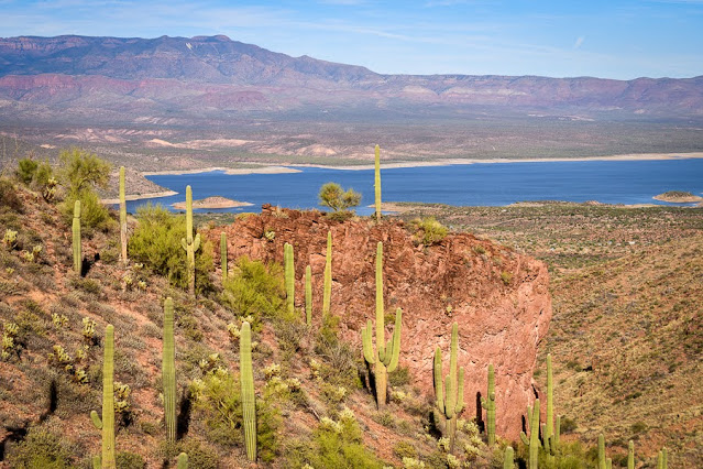 |
| Roosevelt Lake created in 1911 with the damming of the Salt River |
Our next stop was our friend's home in Oro Valley. We met Sue Durling in 2005 on a rafting trip on the Firth River in the Yukon that ended at the Beaufort Sea of the Arctic Ocean. This was our second visit and it was good to catch up. We stayed two nights, had great meals and wandered around Tucson galleries and gardens during the day.
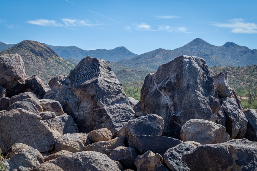
Leaving Oro Valley on our way to Ajo (garlic in Spanish) we stopped at Saguaro National Park West. It is a bit of a drive from Oro Valley so our arrival time was late morning.We did some short hikes off the scenic drive and ended our exploration at Signal Hill to see the petroglyphs. To protect them, there is a barrier encompassing the top of the hill. There is also a sign that says "Rattlesnake Area" perhaps to dissuade those who aren't going to let a barrier stop them.
As a result of the barrier, the best photo can be taken with a long lens from down below Signal Hill.
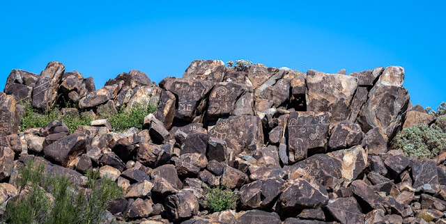 |
| Signal Hill Petroglyphs |
Up on Signal Hill only a few of the petroglyphs are visible. We were here many years ago, perhaps the last time we visited Sue, and I don't recall the barrier, but so many people won't obey the rules and don't care about the damage they leave behind.
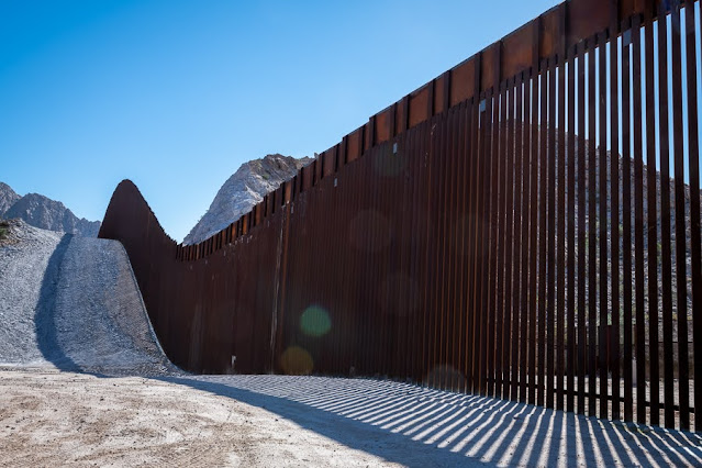
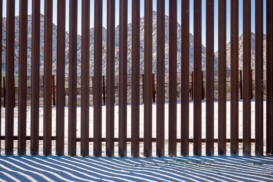
Our next stop was Organ Pipe Cactus National Monument which is right on the US-Mexico border. My car, although all wheel drive, isn't really made for dirt/gravel roads. The ranger said we could drive South Puerto Blanco Drive along the border but couldn't do the loop without a high-clearance vehicle. I found even just driving along the border disconcerting with THE WALL just feet away from the dirt road, but we did. Cell phone coverage was sketchy so this sign wasn't a comfort.
Here the wall is built on US territory and has a one-lane paved road on our side of it. When we were on the dirt road, a border patrol agent/vehicle was sitting on that paved road next to the fence. A few minutes later another border patrol pickup came zipping past my car with a load of migrant men (presumably).
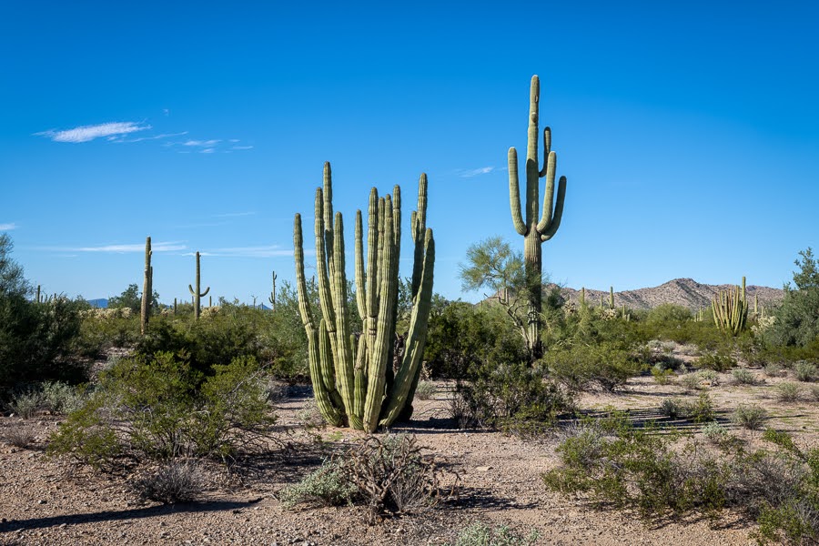
We also came here to see Organ Pipe Cactus of which we didn't see many in the area we could travel.
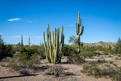 |
| Organ Pipe Cactus (left) Saguaro Cactus (right) |
We stayed the night at the Desert Sonoran Inn in Ajo. Our friend Sue used to live in Ajo many years ago. Ajo is just 43 miles north of the border. It is a nice town trying to remake itself after the closing of the copper mine in 1985. The former Curley Elementary School is now the Desert Sonoran Inn. The rest of the Curley School has been converted to artist live/work spaces.
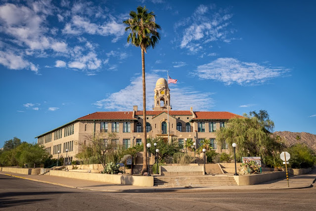 |
| Curley School (1919) now Artist Live-Work Spaces |
 |
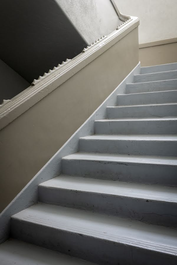
| A Spiked Bannister at Curley School |
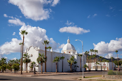 |
| Immaculate Conception Church (1925) |
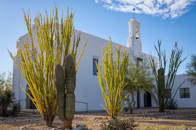 |
| Ajo Federated Church (1926) |
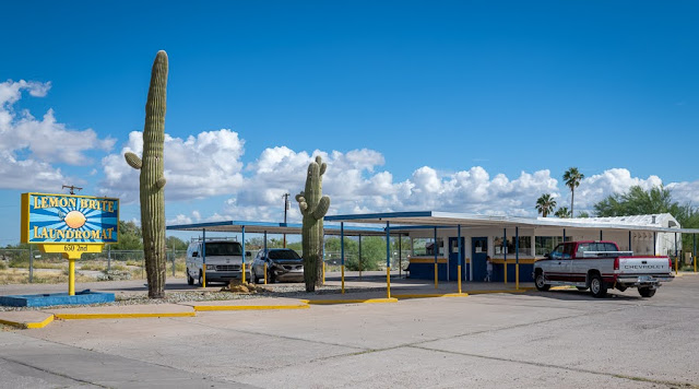 |
| Drive-In Restaurant converted to a Laundromat |
There is a Saturday Farmers/Art market in the town square where javelinas can sometimes be found grazing the lawn. The present population consists of retired people, business owners, border patrol agents/families, and in 2019-2020 Wall construction workers. There is even a coffee roaster in town.
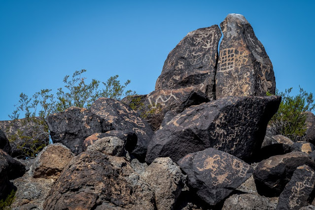
Our next destination was to visit friends (former neighbors Lee and Elaine) who have relocated to the Yuma area. On the way and at their suggestion, we stopped at the Painted Rock Petroglyph site. There are said to be about 800 petroglyphs on weathered basalt boulders scattered over an outcropping. On some boulders there are so many petroglyphs it's like the people who created them were talking over each other.
The oldest Petroglyphs in the Western Archaic style of grids, rakes, ladders, and atlatls are attributed to the hunting and gathering culture that lived in this area between 7500 BCE and 1 CE.
 |
| Western Archaic Style of Petroglyphs |
According to Wikipedia Painted Rock also bears the inscriptions of historic passers-by: "Juan Bautista de Anza passed near here during his 1775-1776 expedition; followed by the Mormon Battalion in the 1840s; the Butterfield Overland Mail; and countless numbers of pioneers. During World War II, General George Patton used this area as headquarters for tank training."
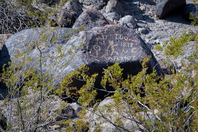 |
| Some inscriptions left by modern visitors |
The Gila Style is attributed to a farming culture that lived in the area about 300 BCE and 1450 CE. This style consists of designs of animals, human shapes, plants, circles, zigzags, and insects.
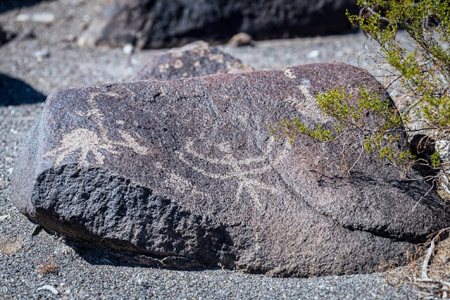 |
| The Gila Style |
Lee and Elaine live in the outskirts of Yuma and very close to the Barry M. Goldwater Range. I've seen so many of Elaine's interesting Wall photos on FB that I was hoping to see it myself. One day they graciously took us for a ride in their Side by Side out into the Barry M. Goldwater Range to see THE WALL. As this range is used for military practice, there are a lot of signs encouraging you to stay on the road.
There is also a distress beacon that advises in both English and Spanish that if you need help to push the button and Border Patrol will arrive in 1 hour. The sign further states: "You cannot walk to safety from this point! You are in Danger of Dying if you do not summon help!"
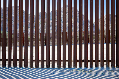 |
| Looking through the new wall to the old wall (Obama era) |
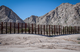 |
| The Old Wall |
 |
| The New Wall |
The new wall looks like a dark ribbon running over mountains and through the desert. It follows the contours of the landscape much the way the Great Wall in China did.
Everything about this two-week road trip was interesting. We saw things we hadn't seen before, we had great photo ops, we learned new stuff, we met up with old friends, and my car did very well.


Comments
Post a Comment